
Desertcart purchases this item on your behalf and handles shipping, customs, and support to Colombia.
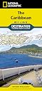
• Waterproof • Tear-Resistant • Travel Map National Geographic's Caribbean Destination Map strikes the perfect balance between map and guidebook and is ideal for a wide range of travelers. The map includes a detailed road network and important travel information including National Parks and protected areas, airports, cruise ports, beaches, historic sites and ruins, and sites for recreation activities including diving, surfing, sailing, and golfing. The front side of the Caribbean Destination Map details the eastern Caribbean and includes beautiful photographs and helpful information on each of the island destinations. The Dominican Republic, Haiti, Puerto Rico, Trinidad and Tobago, Virgin Islands, and the islands of the Lesser Antilles are represented. Also included is important cruising information, inset maps of Charlotte Amalie, U.S. Virgin Islands and Old San Juan, Puerto Rico, and the locations of National Parks. The map also covers the pristine coast of Venezuela. The reverse side of the print map details the western Caribbean, including the Bahamas, Cayman Islands, Cuba, south Florida, Jamaica, and the northern tip of Mexico's Yucatan peninsula. The map features beautiful photographs and information on each location, travel tips, weather information, National Park locations, and a locator map of major embarkation points for Caribbean cruises from the mainland United States. Inset maps for Nassau, Bahamas; George Town, Cayman Islands; Old Havana, Cuba are included. Every Destination map is printed on "Travel-Tough" waterproof, tear-resistant paper. Map Scale = 1:2,000,000 Sheet Size = 37.75" x 25.5" Folded Size = 4.25" x 9.25" Review: Details - Good details on the Caribbean islands. I used it along with my tour book on the Princess Cruise to the East Caribbeans. Review: Great map of the caribean - Great map of the Caribbeans if you're following the narco war. Not much outside the Caribbean. Paper is less expensive had better resolution than the online maps i looked at.


| Best Sellers Rank | #205,988 in Books ( See Top 100 in Books ) #63 in General Caribbean Travel Guides #109 in Beach Travel #155 in Ecotourism Travel Guides |
| Customer Reviews | 4.6 out of 5 stars 116 Reviews |
E**E
Details
Good details on the Caribbean islands. I used it along with my tour book on the Princess Cruise to the East Caribbeans.
K**R
Great map of the caribean
Great map of the Caribbeans if you're following the narco war. Not much outside the Caribbean. Paper is less expensive had better resolution than the online maps i looked at.
M**N
It shows where Puerto Rico is
This map includes Puerto Rico, which is what we needed for a multi cultural fair my daughter participated in. It has landmarks and facts. Good map.
L**D
Used often
Carried this foldable old-school map of Caribbean islands with us on our recent cruise. We reviewed it many times to get a broad perspective of where we were and where we were going next day. I found the map a bit too “busy“ with all of its inset pictures and information. For me – I don’t need all of that and found it distracting. And for a map, I thought the price atop high as well. But there was no other paper map available, and this certainly worked out fine and we were glad to have it. Reviewed it again when we got home and will keep it with my other cruise vacation mementos.
M**A
Yep!
Just the thing for our Caribbean cruise. Complete and easy to read. Nice and colorful.
M**R
Five Stars
It's Ok!!!
B**A
Quality printing but flawed design
High quality printing you would expect from National Geographic, but overall design is flawed by a cluttered arrangement of inset boxes and photos that belong in a travel guide book, not a map. There is a scarcity of quality maps of the Caribbean and I'm still searching for one with both detail and coverage of the surrounding coasts of Mexico, Central and South America. Key cities and geographic detail of those areas are critical to studies of the exploration, conquest, wars, trade, buccaneering and colonization of all the Caribbean islands. Sticking insets of meaningless travel tips and photos to cover important geography I found useless and irritating. Obviously geared for the cruise ship tourist, not a history buff or cartography aficionado.
R**.
Disappointing lack of detail
I should have heeded the comment one reviewer made saying it was more of a tour guide than a detailed map
B**B
Difícil de encontrar, pero ha merecido la pena
Tardó un poco más de lo habitual en llegar porque venía se Estados Unidos, pero mereció totalmente la pena. Amazon ha sido la única plataforma en la que conseguí encontrar este mapa del Caribe de National Geographic. Era un encargo de un familiar y quedó encantado con el regalo. Muy contento con la compra.
B**M
So happy with the details
Always wanted to see the Caribbean Islands on one big picture
Trustpilot
1 month ago
2 weeks ago